
Thank you for supporting this site ❤️
Make a donation
Make a donation
Gear up for your next adventure:
As an Amazon Associate, this site earns from qualifying purchases at no extra cost to you.
Rogery topographic map
Click on the map to display elevation.
Thank you for supporting this site ❤️
Make a donation
Make a donation
Gear up for your next adventure:
As an Amazon Associate, this site earns from qualifying purchases at no extra cost to you.
About this map
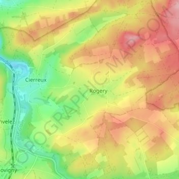
Name: Rogery topographic map, elevation, terrain.
Location: Rogery, Gouvy, Bastogne, Luxembourg, Wallonia, 6671, Belgium (50.22219 5.93025 50.26219 5.97025)
Average elevation: 1,591 ft
Minimum elevation: 1,342 ft
Maximum elevation: 1,844 ft
Thank you for supporting this site ❤️
Make a donation
Make a donation
Gear up for your next adventure:
As an Amazon Associate, this site earns from qualifying purchases at no extra cost to you.