Geolocate

Perry Park topographic map

Click on the map to display elevation.

About this map

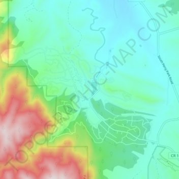
Name: Perry Park topographic map, elevation, terrain.

Location: Perry Park, Douglas County, Colorado, United States (39.23850 -105.02706 39.27999 -104.94478)

Average elevation: 6,814 ft

Minimum elevation: 6,214 ft

Maximum elevation: 8,504 ft

Douglas County trails, hiking, mountain biking, running and outdoor activities

Other topographic maps

Click on a map to view its topography, its elevation and its terrain.

Carriage Club

United States > Colorado > Douglas County > Lone Tree

Average elevation: 5,991 ft

Kistler Park

United States > Colorado > Douglas County

Average elevation: 5,774 ft

Bell Rock

United States > Colorado > Douglas County

Average elevation: 7,920 ft

Orsa

United States > Colorado > Douglas County

Average elevation: 6,056 ft

Heritage Estates

United States > Colorado > Douglas County > Lone Tree

Average elevation: 6,004 ft

Moonridge

United States > Colorado > Douglas County

Average elevation: 7,457 ft

Bayou Hills

United States > Colorado > Douglas County > Bayou Hills

Average elevation: 6,375 ft

Gear up for your next adventure:

🔌USB Car Charger - Car charger for on‑the‑go power needs
🥩Freeze-Dried Meals - Nutritious and lightweight food for remote expeditions
🧣Merino Neck Gaiters - Multi-functional headwear for wind and sun protection
🧭Outdoor Navigation Book - Learn advanced navigation skills
🧤Hiking Gloves - Protective gloves for rugged trails

As an Amazon Associate, this site earns from qualifying purchases at no extra cost to you.