Geolocate

Anahawan topographic map

Click on the map to display elevation.

About this map

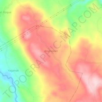
Name: Anahawan topographic map, elevation, terrain.

Location: Anahawan, Calauag, Calabarzon, Philippines (13.90921 122.35780 13.94921 122.39780)

Average elevation: 548 ft

Minimum elevation: 30 ft

Maximum elevation: 945 ft

Gear up for your next adventure:

👟Trail Running Shoes - Lightweight shoes for trail runners
🦶Carbon Trekking Poles - Reduce knee impact on steep descents with ultra-light poles
🛰️Handheld GPS Units - Professional satellite navigators for precise backcountry mapping
🥇GPS Hiking Watch - Multi‑sport GPS watch with navigation and trail tracking
🗺️Topographic Maps - Detailed topo maps for hiking, exploring and outdoor navigation

As an Amazon Associate, this site earns from qualifying purchases at no extra cost to you.