
Horohoro topographic map
Interactive map
Click on the map to display elevation.
About this map
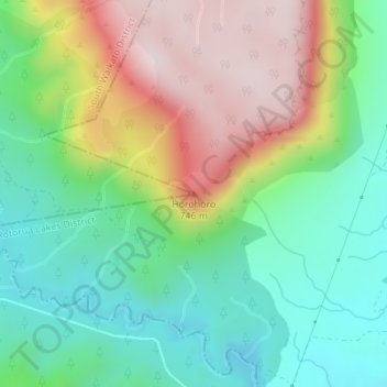
Name: Horohoro topographic map, elevation, terrain.
Location: Horohoro, Rotorua Lakes District, Waikato, New Zealand (-38.27321 176.12922 -38.27311 176.12932)
Average elevation: 1,670 ft
Minimum elevation: 1,030 ft
Maximum elevation: 2,690 ft
Other topographic maps
Click on a map to view its topography, its elevation and its terrain.
Waiotapu
New Zealand > Waikato > Rotorua Lakes District
Waiotapu, Rotorua Lakes District, Waikato, New Zealand
Average elevation: 1,463 ft