
Nunkirchen topographic map
Interactive map
Click on the map to display elevation.
About this map
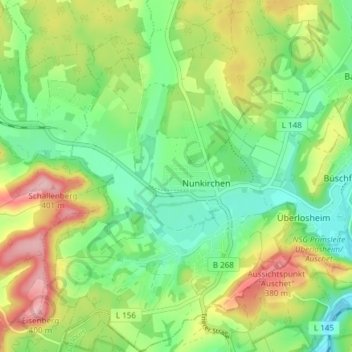
Name: Nunkirchen topographic map, elevation, terrain.
Location: Nunkirchen, Wadern, Landkreis Merzig-Wadern, Saarland, Duitsland (49.46893 6.79988 49.51767 6.85283)
Average elevation: 974 ft
Minimum elevation: 761 ft
Maximum elevation: 1,319 ft