
Thank you for supporting this site ❤️
Make a donation
Make a donation
Gear up for your next adventure:
As an Amazon Associate, this site earns from qualifying purchases at no extra cost to you.
Posadas topographic map
Click on the map to display elevation.
Thank you for supporting this site ❤️
Make a donation
Make a donation
Gear up for your next adventure:
As an Amazon Associate, this site earns from qualifying purchases at no extra cost to you.
About this map
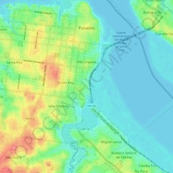
Name: Posadas topographic map, elevation, terrain.
Location: Posadas, Departamento Capital, Misiones, Argentina (-27.46391 -56.02061 -27.34235 -55.86174)
Average elevation: 361 ft
Minimum elevation: 243 ft
Maximum elevation: 571 ft
Thank you for supporting this site ❤️
Make a donation
Make a donation
Gear up for your next adventure:
As an Amazon Associate, this site earns from qualifying purchases at no extra cost to you.