
Puente Virú topographic map
Interactive map
Click on the map to display elevation.
About this map
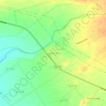
Name: Puente Virú topographic map, elevation, terrain.
Location: Puente Virú, Virú, La Libertad, Perú (-8.44445 -78.79921 -8.40445 -78.75921)
Average elevation: 187 ft
Minimum elevation: 131 ft
Maximum elevation: 236 ft
Other topographic maps
Click on a map to view its topography, its elevation and its terrain.
California
Perú > La Libertad > Virú > California
California, Virú, Provincia de Virú, La Libertad, Perú
Average elevation: 194 ft