
Mechraa Safa topographic map
Interactive map
Click on the map to display elevation.
About this map
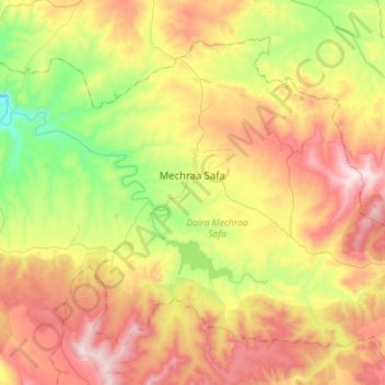
Name: Mechraa Safa topographic map, elevation, terrain.
Location: Mechraa Safa, Daïra Mechraa Safa, Tiaret, 14145, Algérie (35.28150 0.92214 35.46736 1.20305)
Average elevation: 2,359 ft
Minimum elevation: 1,099 ft
Maximum elevation: 3,839 ft