
Dolný Kubín topographic map
Interactive map
Click on the map to display elevation.
About this map
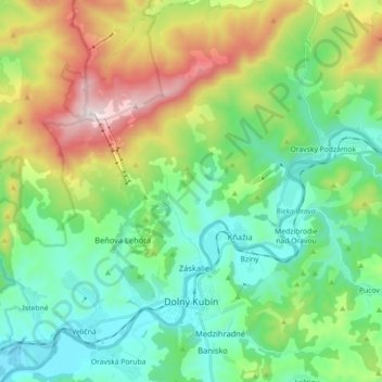
Name: Dolný Kubín topographic map, elevation, terrain.
Average elevation: 2,382 ft
Minimum elevation: 1,453 ft
Maximum elevation: 4,541 ft
Dolný Kubín lies at an altitude of 468 metres (1,535 ft) above sea level and covers an area of 55.055 square kilometres (21.3 sq mi). It is located in northern Slovakia on the Orava River, between the Lesser Fatra, Oravská Magura and Chočské vrchy mountains. It is located around 15 km (9.32 mi) from Ružomberok, 45 km (27.96 mi) from the Polish border and 270 km (167.77 mi) from Bratislava. The town is composed of the following boroughs: Banisko, Beňova Lehota, Brezovec, Kňažia, Malý Bysterec, Medzihradné, Mokraď, Srňacie, Staré mesto, Veľký Bysterec and Záskalie. The city limits also encompass the settlement of Jelšava.