
Les Vorres topographic map
Interactive map
Click on the map to display elevation.
About this map
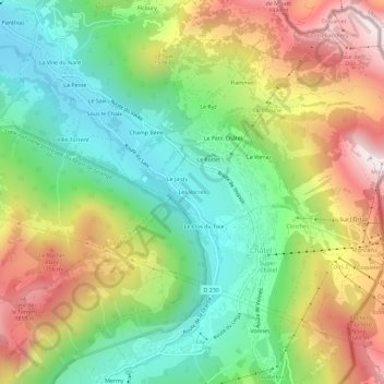
Name: Les Vorres topographic map, elevation, terrain.
Average elevation: 4,610 ft
Minimum elevation: 3,323 ft
Maximum elevation: 6,460 ft
Other topographic maps
Click on a map to view its topography, its elevation and its terrain.
Le Clos du Tour
Frankrijk > Auvergne-Rhône-Alpes > Haute-Savoie > Châtel
Le Clos du Tour, Châtel, Thonon-les-Bains, Haute-Savoie, Auvergne-Rhône-Alpes, Metropolitaans Frankrijk, 74390, Frankrijk
Average elevation: 4,596 ft