
莲花山景区 topographic map
Interactive map
Click on the map to display elevation.
About this map
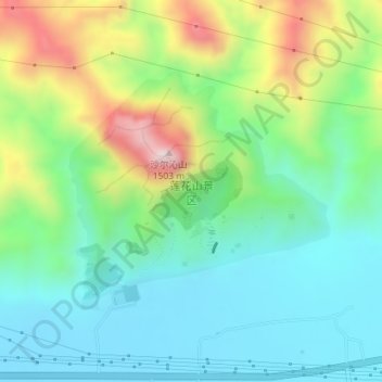
Name: 莲花山景区 topographic map, elevation, terrain.
Location: 莲花山景区, 沙尔沁镇, 东河区, 包头市, 内蒙古自治区, 014000, 中国 (40.56902 110.23472 40.58597 110.25903)
Average elevation: 3,809 ft
Minimum elevation: 3,294 ft
Maximum elevation: 4,967 ft