
La Vigie topographic map
Interactive map
Click on the map to display elevation.
About this map
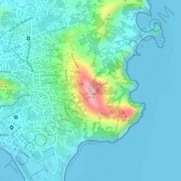
Name: La Vigie topographic map, elevation, terrain.
Location: La Vigie, Pamandzi, Mayotte, 97510, France (-12.79186 45.28874 -12.79176 45.28884)
Average elevation: 118 ft
Minimum elevation: -10 ft
Maximum elevation: 653 ft