
Cabo de Gata topographic map
Interactive map
Click on the map to display elevation.
About this map
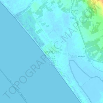
Name: Cabo de Gata topographic map, elevation, terrain.
Location: Cabo de Gata, Almería, Andalusien, 04150, Spanien (36.76114 -2.26218 36.80114 -2.22218)
Average elevation: 7 ft
Minimum elevation: -16 ft
Maximum elevation: 105 ft
Other topographic maps
Click on a map to view its topography, its elevation and its terrain.
Almería
Spanien > Andalusien > Almería
Almería, Andalusien, 04001-04009, Spanien
Average elevation: 820 ft