
横溪街道 topographic map
Interactive map
Click on the map to display elevation.
About this map
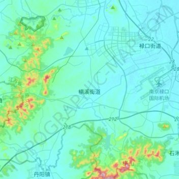
Name: 横溪街道 topographic map, elevation, terrain.
Location: 横溪街道, 江宁区, 南京市, 江苏省, 中国 (31.62087 118.63750 31.82908 118.84257)
Average elevation: 131 ft
Minimum elevation: 10 ft
Maximum elevation: 1,168 ft
Other topographic maps
Click on a map to view its topography, its elevation and its terrain.