
Thank you for supporting this site ❤️
Make a donation
Make a donation
Gear up for your next adventure:
As an Amazon Associate, this site earns from qualifying purchases at no extra cost to you.
Ermidas-Sado topographic map
Click on the map to display elevation.
Thank you for supporting this site ❤️
Make a donation
Make a donation
Gear up for your next adventure:
As an Amazon Associate, this site earns from qualifying purchases at no extra cost to you.
About this map
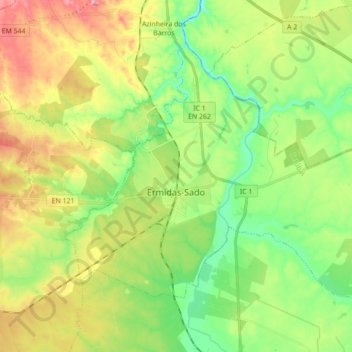
Name: Ermidas-Sado topographic map, elevation, terrain.
Location: Ermidas-Sado, Santiago do Cacém, Setúbal, Portugal (37.96177 -8.46764 38.06639 -8.29314)
Average elevation: 266 ft
Minimum elevation: 56 ft
Maximum elevation: 591 ft
Thank you for supporting this site ❤️
Make a donation
Make a donation
Gear up for your next adventure:
As an Amazon Associate, this site earns from qualifying purchases at no extra cost to you.