Geolocate

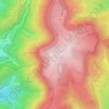
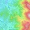
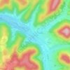
Schuttertal topographic map

Click on the map to display elevation.

About this map

Name: Schuttertal topographic map, elevation, terrain.

Location: Schuttertal, VVG der Gemeinde Seelbach, Ortenaukreis, Baden-Württemberg, 77978, Germany (48.20173 7.90400 48.30544 8.02673)

Average elevation: 1,414 ft

Minimum elevation: 676 ft

Maximum elevation: 2,425 ft

Other topographic maps

Click on a map to view its topography, its elevation and its terrain.

Sommerseite

Germany > Baden-Württemberg > Ortenaukreis > Seebach

Average elevation: 1,965 ft

Kernhof

Germany > Baden-Württemberg > Ortenaukreis > Seebach

Average elevation: 2,477 ft

Schliffkopf

Germany > Baden-Württemberg > Ortenaukreis > Oppenau

Average elevation: 2,835 ft

Waldulm

Germany > Baden-Württemberg > Ortenaukreis

Average elevation: 942 ft

Obergieß

Germany > Baden-Württemberg > Ortenaukreis > Hornberg > Niederwasser

Average elevation: 2,352 ft
Hilsenhof

Germany > Baden-Württemberg > Ortenaukreis > Seebach

Average elevation: 1,736 ft

Gear up for your next adventure:

📌Outdoor GPS Map App - Apps and devices for digital topographic navigation
🛏️Cold Weather Sleeping Bag - Warm sleeping bag for cold conditions
🥾Men's Hiking Boots - Durable, waterproof footwear for rugged terrain and steep inclines
🧼Biodegradable Camping Soap - Eco‑friendly soap for outdoor hygiene
🌧️Backpack Rain Cover - Keep gear dry in wet weather

As an Amazon Associate, this site earns from qualifying purchases at no extra cost to you.