
Sobreira topographic map
Interactive map
Click on the map to display elevation.
About this map
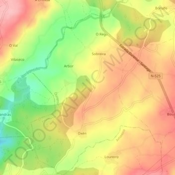
Name: Sobreira topographic map, elevation, terrain.
Location: Sobreira, Vilamarín, Ourense, Galicië, Spanje (42.42253 -7.94431 42.45390 -7.91481)
Average elevation: 1,339 ft
Minimum elevation: 1,076 ft
Maximum elevation: 1,535 ft