Sylt topographic map
Click on the map to display elevation.
Sylt
The island's shape has constantly shifted over time, a process which is still ongoing today. The northern and southern spits of Sylt are exclusively made up of infertile sand deposits, while the central part with the municipalities of Westerland, Wenningstedt-Braderup and Sylt-Ost consists of a geestland core, which becomes apparent in the form of the Red Cliff of Wenningstedt. The geestland facing the Wadden Sea gradually turns into fertile marshland around Sylt-Ost. Sylt has only been an island since the Grote Mandrenke flood of 1362. The so-called Uwe-Düne (Uwe Dune) is the island's highest elevation with 52.5 metres (172.2 feet) above sea level.
About this map
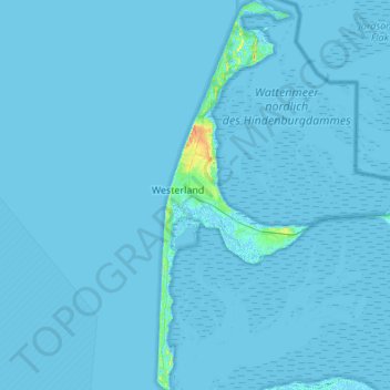
Name: Sylt topographic map, elevation, terrain.
Location: Sylt, Northern Friesland, Schleswig-Holstein, Germany (54.74474 8.27846 55.05866 8.48996)
Average elevation: 0 ft
Minimum elevation: -7 ft
Maximum elevation: 121 ft
Other topographic maps
Click on a map to view its topography, its elevation and its terrain.