
大悟县 topographic map
Interactive map
Click on the map to display elevation.
About this map
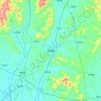
Name: 大悟县 topographic map, elevation, terrain.
Location: 大悟县, 孝感市, 湖北省, 中国 (31.40284 113.96081 31.72284 114.28081)
Average elevation: 492 ft
Minimum elevation: 135 ft
Maximum elevation: 2,585 ft
Other topographic maps
Click on a map to view its topography, its elevation and its terrain.