
Kati topographic map
Interactive map
Click on the map to display elevation.
About this map
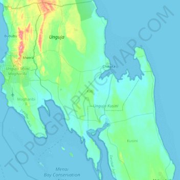
Name: Kati topographic map, elevation, terrain.
Location: Kati, Unguja Sud et Central, Zanzibar زنجبار, 72210, Tanzanie (-6.41249 39.26904 -6.02146 39.52957)
Average elevation: 43 ft
Minimum elevation: -3 ft
Maximum elevation: 407 ft