
Santa Rosa Park topographic map
Interactive map
Click on the map to display elevation.
About this map
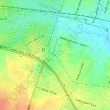
Name: Santa Rosa Park topographic map, elevation, terrain.
Location: Santa Rosa Park, Killeen, Bell County, Texas, USA (31.11076 -97.74454 31.11122 -97.74410)
Average elevation: 886 ft
Minimum elevation: 817 ft
Maximum elevation: 971 ft