
Vevelstad topographic map
Interactive map
Click on the map to display elevation.
About this map
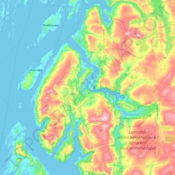
Name: Vevelstad topographic map, elevation, terrain.
Location: Vevelstad, Nordland, Noruega (65.51737 12.22693 65.78975 13.04099)
Average elevation: 971 ft
Minimum elevation: -13 ft
Maximum elevation: 3,757 ft
Other topographic maps
Click on a map to view its topography, its elevation and its terrain.