
Granada (Municipio) topographic map
Interactive map
Click on the map to display elevation.
About this map
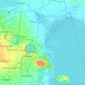
Name: Granada (Municipio) topographic map, elevation, terrain.
Location: Granada (Municipio), Granada, 43000, Nicaragua (11.70049 -86.03534 12.21458 -85.67037)
Average elevation: 420 ft
Minimum elevation: 85 ft
Maximum elevation: 4,265 ft
Other topographic maps
Click on a map to view its topography, its elevation and its terrain.