Geolocate

Accord topographic map

Click on the map to display elevation.

About this map
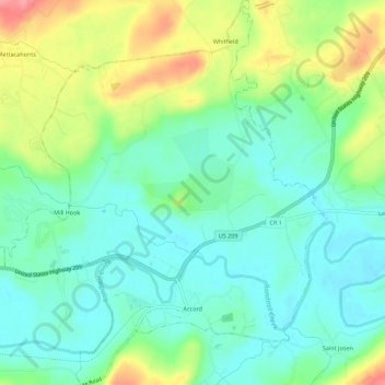
Name: Accord topographic map, elevation, terrain.

Location: Accord, Town of Rochester, Ulster County, New York, United States (41.77744 -74.25605 41.81863 -74.20969)

Average elevation: 308 ft

Minimum elevation: 210 ft

Maximum elevation: 512 ft

Ulster County trails, hiking, mountain biking, running and outdoor activities

Gear up for your next adventure:

🌡️Portable Weather Meter - Track weather conditions on the trail
🦺Reflective Outdoor Gear - Safety gear for low‑light conditions
📡Handheld GPS Device - Reliable handheld GPS for outdoor navigation
🏥Hiking First Aid Kits - Comprehensive medical kits for remote trail injuries
📱Solar Portable Charger - Solar power bank for charging devices off‑grid

As an Amazon Associate, this site earns from qualifying purchases at no extra cost to you.