
Thank you for supporting this site ❤️
Make a donation
Make a donation
Gear up for your next adventure:
As an Amazon Associate, this site earns from qualifying purchases at no extra cost to you.
Berisso topographic map
Click on the map to display elevation.
Thank you for supporting this site ❤️
Make a donation
Make a donation
Gear up for your next adventure:
As an Amazon Associate, this site earns from qualifying purchases at no extra cost to you.
About this map
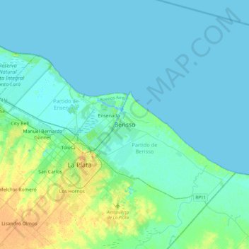
Name: Berisso topographic map, elevation, terrain.
Location: Berisso, Partido de Berisso, Buenos Aires, 1923, Argentina (-35.02886 -58.04287 -34.70886 -57.72287)
Average elevation: 20 ft
Minimum elevation: -3 ft
Maximum elevation: 121 ft
Thank you for supporting this site ❤️
Make a donation
Make a donation
Gear up for your next adventure:
As an Amazon Associate, this site earns from qualifying purchases at no extra cost to you.