
Unnamed (No.HA931) Heritage Agreement topographic map
Interactive map
Click on the map to display elevation.
About this map
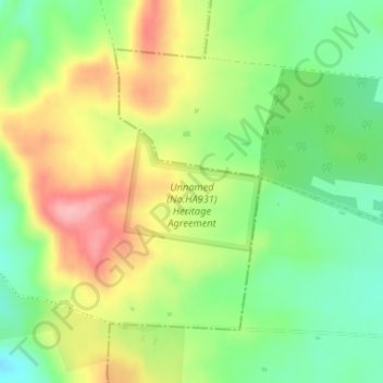
Name: Unnamed (No.HA931) Heritage Agreement topographic map, elevation, terrain.
Average elevation: 1,391 ft
Minimum elevation: 1,191 ft
Maximum elevation: 1,640 ft