
Valcanale topographic map
Interactive map
Click on the map to display elevation.
About this map
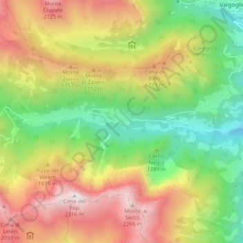
Name: Valcanale topographic map, elevation, terrain.
Location: Valcanale, Ardesio, Bergamo, Lombardia, Italia (45.94735 9.84791 45.95132 9.92405)
Average elevation: 4,646 ft
Minimum elevation: 2,310 ft
Maximum elevation: 7,536 ft
Other topographic maps
Click on a map to view its topography, its elevation and its terrain.