

Chalmazel topographic map
Click on the map to display elevation.
Chalmazel
The commune of Chalmazel lies at the heart of the Forez mountains, a mountain range in the Massif Central separating the Dore valley from the Forez plain. The village lies at an altitude of 800 metres on the side of a valley bordered by the Lignon, a tributary of the Loire. The boundary of the commune is marked to the east by the Col de la Croix de Ladret (1,046 metres) and the Pic de Morière (1,137 metres), and to the west by the Col du Béal (1,390 metres) and the massif's highest point, Pierre-sur-Haute (1,631 metres). However, the latter is located on the commune of Sauvain for some 250 meters, unlike the winter sports resort on its flank, which remains on Chalmazel. The ridge running through the Col du Béal and Pierre-sur-Haute also marks the separation between the departments of Loire (Rhône-Alpes region) and Puy-de-Dôme (Auvergne region). It is home to vast, undulating plateaux of moorland dotted with peat bogs, known as the hautes Chaumes, classified Natura 2000 for their floristic interest.
About this map
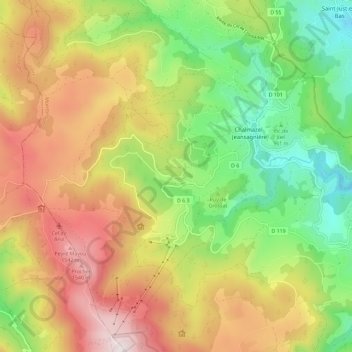
Name: Chalmazel topographic map, elevation, terrain.
Average elevation: 3,796 ft
Minimum elevation: 2,480 ft
Maximum elevation: 5,364 ft