
El Suspiro topographic map
Interactive map
Click on the map to display elevation.
About this map
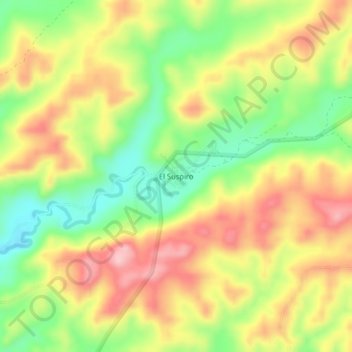
Name: El Suspiro topographic map, elevation, terrain.
Location: El Suspiro, Parroquia Colonche, Santa Elena, Ecuador (-1.91520 -80.64423 -1.87520 -80.60423)
Average elevation: 486 ft
Minimum elevation: 184 ft
Maximum elevation: 784 ft