
Thank you for supporting this site ❤️
Make a donation
Make a donation
Gear up for your next adventure:
As an Amazon Associate, this site earns from qualifying purchases at no extra cost to you.
Nogueras topographic map
Click on the map to display elevation.
Thank you for supporting this site ❤️
Make a donation
Make a donation
Gear up for your next adventure:
As an Amazon Associate, this site earns from qualifying purchases at no extra cost to you.
About this map
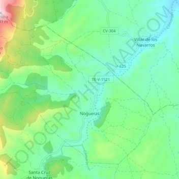
Name: Nogueras topographic map, elevation, terrain.
Location: Nogueras, Jiloca, Teruel, Aragon, Spain (41.11829 -1.11765 41.16770 -1.03911)
Average elevation: 3,002 ft
Minimum elevation: 2,510 ft
Maximum elevation: 4,390 ft
Thank you for supporting this site ❤️
Make a donation
Make a donation
Gear up for your next adventure:
As an Amazon Associate, this site earns from qualifying purchases at no extra cost to you.