
Maria Saal topographic map
Interactive map
Click on the map to display elevation.
About this map
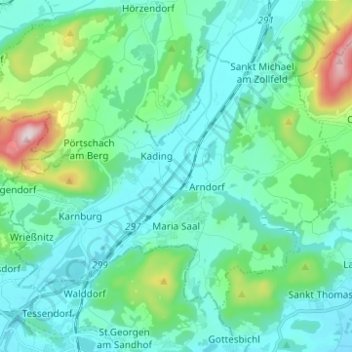
Name: Maria Saal topographic map, elevation, terrain.
Location: Maria Saal, Bezirk Klagenfurt-Land, Carinthie, 9063, Autriche (46.66031 14.28139 46.72551 14.40528)
Average elevation: 1,775 ft
Minimum elevation: 1,434 ft
Maximum elevation: 3,304 ft