
daïra Oued Fodda topographic map
Interactive map
Click on the map to display elevation.
About this map
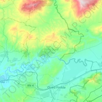
Name: daïra Oued Fodda topographic map, elevation, terrain.
Location: daïra Oued Fodda, Chlef, RADP (36.15762 1.43716 36.35535 1.63236)
Average elevation: 1,089 ft
Minimum elevation: 328 ft
Maximum elevation: 3,747 ft
Other topographic maps
Click on a map to view its topography, its elevation and its terrain.
Sidi Merouane
RADP > Chlef > Sidi Merouane
Sidi Merouane, Daïra Ténès, Chlef, 02006, RADP
Average elevation: 390 ft