
Isla Acuy topographic map
Interactive map
Click on the map to display elevation.
About this map
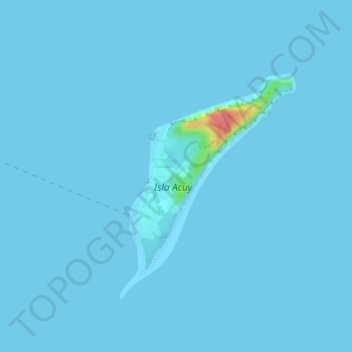
Name: Isla Acuy topographic map, elevation, terrain.
Average elevation: 3 ft
Minimum elevation: 0 ft
Maximum elevation: 230 ft
Other topographic maps
Click on a map to view its topography, its elevation and its terrain.
Isla Tranqui
Chile > Región de Los Lagos > Queilén
Isla Tranqui, Queilén, Provincia de Chiloé, Región de Los Lagos, Chile
Average elevation: 75 ft