
Courelas topographic map
Interactive map
Click on the map to display elevation.
About this map
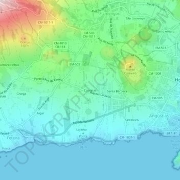
Name: Courelas topographic map, elevation, terrain.
Location: Courelas, Horta, Faial, Açores, 9900-404, Portugal (38.51449 -28.67592 38.55449 -28.63592)
Average elevation: 322 ft
Minimum elevation: 0 ft
Maximum elevation: 1,522 ft