Geolocate

Razgrad topographic map

Click on the map to display elevation.

About this map
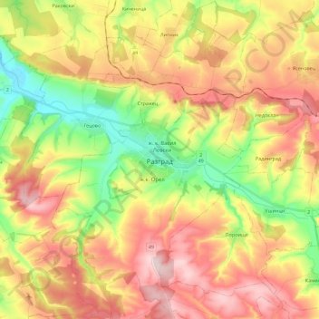
Name: Razgrad topographic map, elevation, terrain.

Location: Razgrad, Bulgaria (43.44528 26.44991 43.60785 26.59030)

Average elevation: 1,033 ft

Minimum elevation: 568 ft

Maximum elevation: 1,496 ft

Gear up for your next adventure:

🏕️Tent Footprint - Protect your tent base from wear
🛏️Cold Weather Sleeping Bag - Warm sleeping bag for cold conditions
🎒Day Hiking Backpack - Lightweight backpack perfect for day trips and outdoor adventures
🛡️Insect Repellent - Protection against bugs during outdoor activities
⛑️Personal Locator Beacon - Safety beacon for emergencies

As an Amazon Associate, this site earns from qualifying purchases at no extra cost to you.