
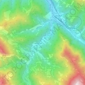
Tetto Garaud topographic map
Interactive map
Click on the map to display elevation.
About this map
Name: Tetto Garaud topographic map, elevation, terrain.
Location: Tetto Garaud, Vernante, Coni, Piémont, 12019, Italie (44.21126 7.50550 44.25126 7.54550)
Average elevation: 3,698 ft
Minimum elevation: 2,516 ft
Maximum elevation: 5,958 ft
Other topographic maps
Click on a map to view its topography, its elevation and its terrain.
Tetto Cace
Italie > Piémont > Coni > Vernante
Tetto Cace, Vernante, Coni, Piémont, 12019, Italie
Average elevation: 3,911 ft
Tetto Bertola
Italie > Piémont > Coni > Vernante > Tetto Bertola
Tetto Bertola, Vernante, Coni, Piémont, 12019, Italie
Average elevation: 3,737 ft