
Rivière à Mars topographic map
Interactive map
Click on the map to display elevation.
About this map
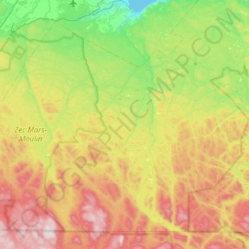
Name: Rivière à Mars topographic map, elevation, terrain.
Average elevation: 1,299 ft
Minimum elevation: 0 ft
Maximum elevation: 3,376 ft
Other topographic maps
Click on a map to view its topography, its elevation and its terrain.
Zec Mars-Moulin
Canada > Québec > Le Fjord-du-Saguenay > Lac-Ministuk
Zec Mars-Moulin, Lac-Ministuk, Le Fjord-du-Saguenay, Saguenay–Lac-Saint-Jean, Québec, Canada
Average elevation: 1,506 ft