
Koror topographic map
Interactive map
Click on the map to display elevation.
About this map
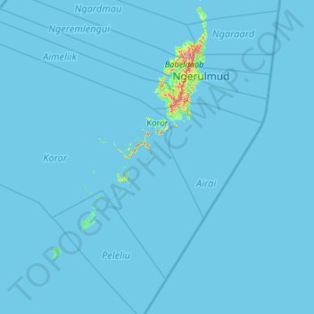
Name: Koror topographic map, elevation, terrain.
Location: Koror, Palau (6.81762 133.57407 7.63730 134.63361)
Average elevation: 7 ft
Minimum elevation: -3 ft
Maximum elevation: 653 ft
Other topographic maps
Click on a map to view its topography, its elevation and its terrain.
Mount Ngerchelchuus
Mount Ngerchelchuus, Ngeremlengui, Palau
Average elevation: 413 ft