
نغندر طرقبه topographic map
Interactive map
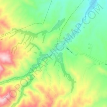
Click on the map to display elevation.
About this map
Name: نغندر طرقبه topographic map, elevation, terrain.
Average elevation: 4,800 ft
Minimum elevation: 4,334 ft
Maximum elevation: 5,440 ft
Other topographic maps
Click on a map to view its topography, its elevation and its terrain.
Shandiz
Iran > Razavi Khorasan > torghabeh shandiz County > Shandiz City
Shandiz, Shandiz City, بخش شاندیز, torghabeh shandiz County, Razavi Khorasan, Iran
Average elevation: 4,505 ft