Geolocate

Moti Island topographic map

Click on the map to display elevation.

About this map
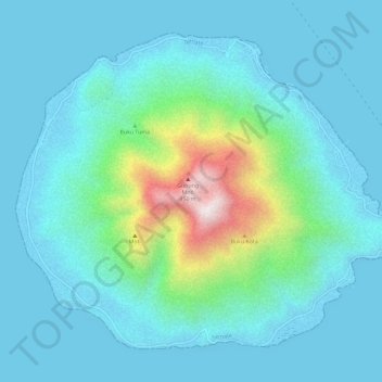
Name: Moti Island topographic map, elevation, terrain.

Location: Moti Island, Ternate, North Maluku, Indonesia (0.43272 127.38186 0.48075 127.43990)

Average elevation: 479 ft

Minimum elevation: -3 ft

Maximum elevation: 3,012 ft

Other topographic maps

Click on a map to view its topography, its elevation and its terrain.

Kota Baru

Indonesia > North Maluku > Ternate

Average elevation: 144 ft

Gear up for your next adventure:

🔦LED Headlamp - Bright and durable LED headlamp for night navigation
🧦Hiking Socks - Comfortable socks to prevent blisters on long hikes
🔥Plasma Lighters - Windproof lighters that work in any weather condition
🧥Men's Rain Shells - Premium waterproof and breathable jackets for mountain weather
🩳Quick‑Dry Hiking Shorts - Comfortable and quick‑dry shorts for summer hiking

As an Amazon Associate, this site earns from qualifying purchases at no extra cost to you.