
Villa de Casas topographic map
Interactive map
Click on the map to display elevation.
About this map
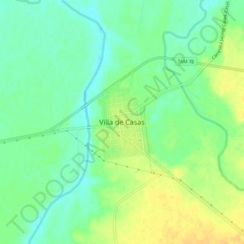
Name: Villa de Casas topographic map, elevation, terrain.
Location: Villa de Casas, Casas, Tamaulipas, México (23.70644 -98.75708 23.74644 -98.71708)
Average elevation: 499 ft
Minimum elevation: 456 ft
Maximum elevation: 548 ft