
Farkë topographic map
Interactive map
Click on the map to display elevation.
About this map
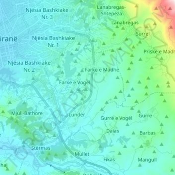
Name: Farkë topographic map, elevation, terrain.
Average elevation: 820 ft
Minimum elevation: 331 ft
Maximum elevation: 4,396 ft
Other topographic maps
Click on a map to view its topography, its elevation and its terrain.
Liqeni i Farkës
Albania > Central Albania > Tirana County > Tirana Municipality > Mollasej (Farka e Vogël)
Liqeni i Farkës, Mollasej (Farka e Vogël), Farkë, Tirana Municipality, Tirana County, Central Albania, 1045, Albania
Average elevation: 640 ft