
Thank you for supporting this site ❤️
Make a donation
Make a donation
Gear up for your next adventure:
As an Amazon Associate, this site earns from qualifying purchases at no extra cost to you.
Lermoos topographic map
Click on the map to display elevation.
Thank you for supporting this site ❤️
Make a donation
Make a donation
Gear up for your next adventure:
As an Amazon Associate, this site earns from qualifying purchases at no extra cost to you.
About this map
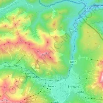
Name: Lermoos topographic map, elevation, terrain.
Location: Lermoos, Bezirk Reutte, Tyrol, 6631, Austria (47.38219 10.81624 47.48555 10.93846)
Average elevation: 4,446 ft
Minimum elevation: 2,648 ft
Maximum elevation: 8,419 ft
Thank you for supporting this site ❤️
Make a donation
Make a donation
Gear up for your next adventure:
As an Amazon Associate, this site earns from qualifying purchases at no extra cost to you.