
Canevara topographic map
Interactive map
Click on the map to display elevation.
About this map
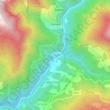
Name: Canevara topographic map, elevation, terrain.
Location: Canevara, Massa, Massa-Carrara, Toscane, Italie (44.05824 10.16620 44.05886 10.16817)
Average elevation: 1,253 ft
Minimum elevation: 197 ft
Maximum elevation: 2,848 ft
Other topographic maps
Click on a map to view its topography, its elevation and its terrain.
Passo della Focolaccia
Passo della Focolaccia, Massa, Massa-Carrara, Toscane, Italie
Average elevation: 4,636 ft