
Mook en Middelaar topographic map
Interactive map
Click on the map to display elevation.
About this map
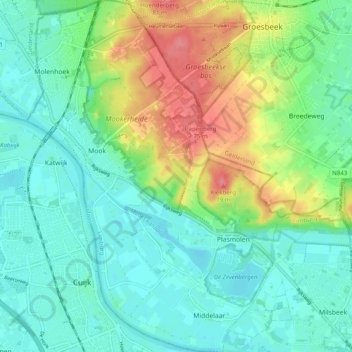
Name: Mook en Middelaar topographic map, elevation, terrain.
Location: Mook en Middelaar, Limburg, Nederland (51.71767 5.86447 51.77863 5.93830)
Average elevation: 89 ft
Minimum elevation: 16 ft
Maximum elevation: 253 ft
Other topographic maps
Click on a map to view its topography, its elevation and its terrain.
Plasmolen
Nederland > Limburg > Mook en Middelaar
Plasmolen, Mook en Middelaar, Limburg, Nederland
Average elevation: 89 ft