
Lenzspitze topographic map
Interactive map
Click on the map to display elevation.
About this map
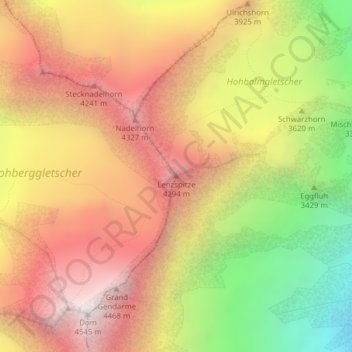
Name: Lenzspitze topographic map, elevation, terrain.
Location: Lenzspitze, Saas-Fee, Visp, Valais/Wallis, 3906, Switzerland (46.10450 7.86861 46.10460 7.86871)
Average elevation: 12,185 ft
Minimum elevation: 8,743 ft
Maximum elevation: 14,888 ft
Other topographic maps
Click on a map to view its topography, its elevation and its terrain.
Allalinhorn
Switzerland > Valais/Wallis > Saas-Fee
Allalinhorn, Saas-Fee, Visp, Valais/Wallis, 3906, Switzerland
Average elevation: 11,450 ft