
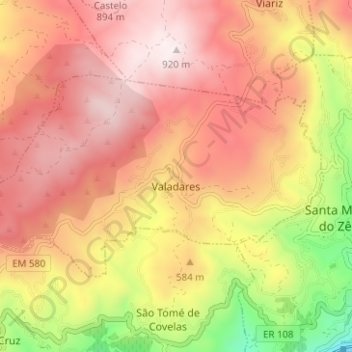
Valadares topographic map
Interactive map
Click on the map to display elevation.
About this map
Name: Valadares topographic map, elevation, terrain.
Location: Valadares, Baião, Porto, Portugal (41.13390 -8.01691 41.16096 -7.95431)
Average elevation: 1,870 ft
Minimum elevation: 161 ft
Maximum elevation: 2,989 ft