
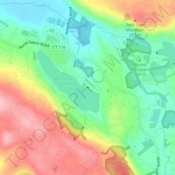
Mamanasco Lake Dam topographic map
Interactive map
Click on the map to display elevation.
About this map
Name: Mamanasco Lake Dam topographic map, elevation, terrain.
Average elevation: 689 ft
Minimum elevation: 476 ft
Maximum elevation: 984 ft
Other topographic maps
Click on a map to view its topography, its elevation and its terrain.
Ridgefield
United States > Connecticut > Western Connecticut Planning Region > Ridgefield
Ridgefield, Western Connecticut Planning Region, Connecticut, United States
Average elevation: 673 ft
West Mountain
United States > Connecticut > Western Connecticut Planning Region > Ridgefield
West Mountain, Ridgefield, Western Connecticut Planning Region, Connecticut, 06877, United States
Average elevation: 794 ft
Ridgebury
United States > Connecticut > Western Connecticut Planning Region > Ridgefield
Ridgebury, Ridgefield, Western Connecticut Planning Region, Connecticut, 96810, United States
Average elevation: 640 ft