
Villamayor de Monjardín topographic map
Interactive map
Click on the map to display elevation.
About this map
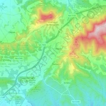
Name: Villamayor de Monjardín topographic map, elevation, terrain.
Location: Villamayor de Monjardín, Navarra - Nafarroa, 31242, Spanje (42.57306 -2.16562 42.64529 -2.08456)
Average elevation: 1,946 ft
Minimum elevation: 1,473 ft
Maximum elevation: 3,114 ft