
West Ghent topographic map
Interactive map
Click on the map to display elevation.
About this map
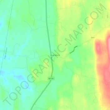
Name: West Ghent topographic map, elevation, terrain.
Average elevation: 236 ft
Minimum elevation: 105 ft
Maximum elevation: 463 ft
Other topographic maps
Click on a map to view its topography, its elevation and its terrain.
Pulvers
United States > New York > Columbia County > Town of Ghent
Pulvers, Town of Ghent, Columbia County, New York, 12075, United States
Average elevation: 364 ft
Arnolds Mill
United States > New York > Columbia County > Town of Ghent
Arnolds Mill, Town of Ghent, Columbia County, New York, 12037, United States
Average elevation: 584 ft
Omi
United States > New York > Columbia County > Town of Ghent
Omi, Town of Ghent, Columbia County, New York, 12075, United States
Average elevation: 305 ft
Buckleyville
United States > New York > Columbia County > Town of Ghent
Buckleyville, Town of Ghent, Columbia County, New York, 12037, United States
Average elevation: 515 ft